

Mexico isn’t just one big taco stand — it’s a spicy patchwork of regional flavors, each with its own personality, palette, and pantry. Think of it like a giant spice box where every drawer opens to a different scent, color, and heat level.
In this blog, we’ll take a flavorful journey through Mexico’s seven distinct culinary regions, uncovering their signature spices, iconic dishes, and the cultural stories behind the seasonings that make Mexican food so unforgettable.
Table of Contents
- What Makes Each Region Unique?
- Central Mexico: The Heart of Mole & Maíz
- Northern Mexico: Meat, Smoke, and Bold Flavors
- Southern Mexico: Ancient Roots & Earthy Heat
- Gulf Coast: Citrus, Seafood & Tangy Twists
- Pacific Coast: Bright, Fresh, and Fire-Friendly
- Yucatán Peninsula: Achiote, Habanero & Mayan Magic
- Baja California: Surfer Spice & Coastal Cool
- Spice Comparison Chart
- Final Thoughts
What Makes Each Region Unique?
Mexico is divided into seven major culinary regions, each shaped by geography, climate, indigenous heritage, and colonial influences. These factors determine which ingredients thrive — and which spices become stars.
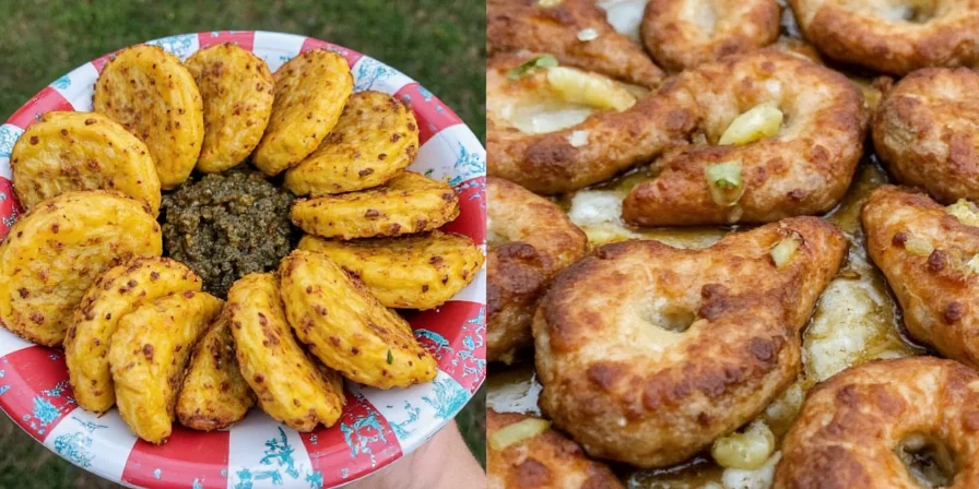
Beyond geography, these spice traditions reveal deeper cultural narratives. Achiote’s journey from Mayan body paint to Yucatecan kitchens demonstrates how pre-Hispanic practices survived colonization. Similarly, Northern Mexico’s smoked chipotle reflects indigenous preservation techniques adapted to arid landscapes. Each spice carries centuries of adaptation often overlooked in mainstream culinary discussions.
The key players in Mexican spice blends include:
- Chiles (dried and fresh)
- Achiote
- Cumin
- Oregano
- Garlic
- Pasilla, mulato, and ancho chiles
- Tangy citrus zest
- Smoked paprika
Let’s dive into each region and explore what makes them sizzle!
Central Mexico: The Heart of Mole & Maíz
If Mexico had a spice capital, it would be Central Mexico. Home to Puebla and Tlaxcala, and close to Mexico City, this region is the birthplace of mole — the complex, layered sauce that can include up to 30 ingredients.
Signature Spices:
- Ancho chile
- Pasilla chile
- Cinnamon
- Chocolate
- Cumin
- Toasted almonds or sesame seeds
Classic Dishes:
- Mole Poblano
- Romero de pollo (chicken in pasilla sauce)
- Chiles en nogada
Pro Tip:
Make your own mole at home by roasting the dried chiles first — it unlocks a deeper, smokier flavor profile.
Northern Mexico: Meat, Smoke, and Bold Flavors
In the arid north, especially in states like Chihuahua and Coahuila, the cuisine is all about bold flavors and hearty ingredients. With large cattle ranches and open skies, this region leans heavily into grilled meats and robust spices.
Signature Spices:
- Jalapeño
- Chipotle (smoked jalapeño)
- Garlic powder
- Black pepper
- Dried oregano
Classic Dishes:
- Carne asada
- Arrachera (skirt steak)
- Fajitas
Pro Tip:
Try marinating beef overnight with chipotle in adobo for a rich, smoky depth.
Southern Mexico: Ancient Roots & Earthy Heat
Home to Oaxaca, Chiapas, and Tabasco, Southern Mexico is a spice haven rooted in ancient Maya and Zapotec traditions. Here, you’ll find earthy tones, deep roasts, and chiles that hit the soul more than the tongue.
Signature Spices:
- Guajillo chile
- Pasilla Mixe
- Hoja santa (Mexican pepperleaf)
- Epazote
- Wild oregano
Classic Dishes:
- Memela oaxaqueña
- Mole negro
- Tamales de chipilín
Pro Tip:
Don’t skip hoja santa — it adds a licorice-like note that’s hard to replicate but worth tracking down.
Gulf Coast: Citrus, Seafood & Tangy Twists
Veracruz and Campeche bring briny breezes and tropical tang to the table. This region uses less smoke and more brightness — think citrus, tomato, and herbs that balance out heavier seafoods.
Signature Spices:
- Orange zest
- Lime juice
- Green chili (like serrano)
- Cilantro
- Capers
Classic Dishes:
- Arroz a la tumbada (seafood rice)
- Mojarra frita con limón
- Coctel de camarón
Pro Tip:
Try using orange zest instead of lime for a sweeter, floral kick in ceviche.
Yucatán Peninsula: Achiote, Habanero & Mayan Magic
This region has a spice identity all its own, thanks to Mayan roots and Caribbean influences. Yucatecan cooking relies on the “trinity” of spices: achiote, bitter orange, and habanero.
Signature Spices:
- Achiote paste
- Habanero chile
- Bitter orange juice (or a mix of lemon + lime)
- Cumin
- Allspice
Classic Dishes:
- Cochinita pibil
- Sopa de lima
- Pavo en relleno negro
Pro Tip:
Make your own achiote paste with vinegar, garlic, and spices — it keeps well in the fridge for weeks.
Pacific Coast: Bright, Fresh, and Fire-Friendly
From Nayarit to Sinaloa, the Pacific Coast offers a lighter, fresher approach to spice. This region loves grilled fish, citrus marinades, and fresh herbs that enhance rather than overpower.
Signature Spices:
- Lime juice
- Serrano chile
- Cilantro
- Cumin
- Tomatillo
Classic Dishes:
- Tacos dorados de pescado
- Guisado de mariscos
- Ensalada de nopales
Pro Tip:
Try making salsa verde with roasted tomatillos and serrano for a zesty condiment that pairs with almost anything.
Baja California: Surfer Spice & Coastal Cool
Far from the inland heat, Baja California brings a surf-and-turf style to the table. Influenced by both American fast food culture and traditional Mexican seafood dishes, the spice palette here is subtle and refreshing.
Signature Spices:
- Black pepper
- Lime juice
- Avocado crema
- Coriander seeds
- Garlic powder
Classic Dishes:
- Ceviche tostadas
- Baja fish tacos
- Agua fresca
Pro Tip:
Use avocado crema instead of sour cream for a richer, creamier finish without the dairy overload.
Spice Comparison Chart: From Mild to Wild 🌶️🌶️🌶️
| Region | Signature Spices | Flavor Profile | Best For |
|---|---|---|---|
| Central Mexico | Ancho, chocolate, cinnamon | Deep, sweet, complex | Mole lovers |
| Northern Mexico | Chipotle, garlic, cumin | Smoky, savory, bold | Grilled meat lovers |
| Southern Mexico | Guajillo, epazote, hoja santa | Earthy, herbal, rustic | Traditionalists |
| Gulf Coast | Lime, orange zest, cilantro | Tangy, bright, coastal | Seafood fans |
| Yucatán Peninsula | Achiote, habanero, bitter orange | Smoky, citrusy, fiery | Adventure seekers |
| Pacific Coast | Serrano, cumin, coriander | Fresh, zesty, balanced | Light eaters |
| Baja California | Lime, black pepper, avocado crema | Cool, crisp, clean | Casual bites |
Conclusion: Spice It Up, Region by Region 🌍🔥
Mexico’s spice story is more than just heat — it’s a tapestry of culture, history, and geography woven into every bite. Whether you’re craving the smoky richness of the North, the floral freshness of the Gulf Coast, or the earthy mystique of the South, there’s a region (and a recipe) waiting to spice up your life.
Next time you reach for that jar of chili powder or dream of a taco truck, remember: you’re tasting centuries of tradition in every crunch, aroma, and kick. Now go ahead — turn up the heat and let your taste buds travel across the seven regions of Mexico.
Frequently Asked Questions
Which region features chocolate in savory dishes?
Central Mexico, particularly Puebla, uniquely incorporates chocolate into mole poblano. This complex sauce balances cocoa's bitterness with chile heat and spices, creating a sophisticated flavor profile absent in other regions' savory cooking.
Why does Yucatán use bitter orange instead of regular orange?
Bitter orange (naranja agria) provides a distinctive tartness essential to Yucatecan identity. Its sharp flavor cuts through rich achiote-marinated meats and complements habanero heat, reflecting Mayan culinary principles where balance between sweet, sour, and spicy elements is paramount.
How does elevation affect spice usage in Southern Mexico?
Highland regions like Oaxaca favor slow-cooked moles with earthy spices (epazote, hoja santa) that develop depth over time, while coastal Southern areas use brighter citrus notes. This elevation-driven contrast shows how microclimates create hyperlocal variations within the same culinary region.
What's the most overlooked spice in Northern Mexican cuisine?
Dried wild oregano is Northern Mexico's secret weapon. Unlike Mediterranean oregano, its floral notes enhance grilled meats without overpowering them, demonstrating how indigenous foraging traditions shaped regional palates long before European herbs arrived.
Want more spice wisdom? Keep reading for our upcoming posts on global spice blends and how to build your own spice rack like a pro!




 浙公网安备
33010002000092号
浙公网安备
33010002000092号 浙B2-20120091-4